

Devlog · Maps
Building Al-Andalus: From Historical Maps to a Living World
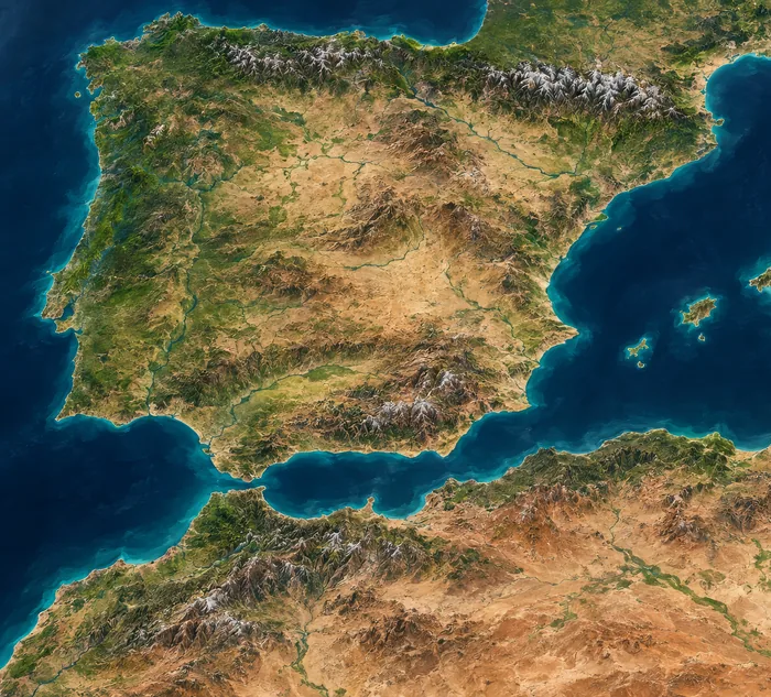
Al-Andalus is the first campaign of Medieval Realms: Dynasties. The map you see on this site is the same campaign map the game uses. It is not a decorative illustration, and it is not a historical source of truth.
Cities decide, provinces follow
The world is not drawn as freehand kingdoms. Each province is built around one city: a real place, anchored on the painted land, then turned into a cell that shares its edges with its neighbours. Change an anchor, a region boundary or the shared-border threshold and the graph changes — movement, adjacency and balance change with it.
Cities decide, provinces follow. Nobody codes geometry by hand.
Three regions on the playable map
The campaign is split into Iberia, the Maghreb and Ibiza. Iberia holds most of the confirmed cities, from coasts to interior plains and highlands. The Maghreb sits south of the strait: crossing to Iberia is a slower maritime step. Ibiza is a separate island, reached by a sea link. No other region is playable or announced as ready.
That image is the current official map. Earlier painted stages exist in the production pipeline, but they are not published here as a before-and-after pair: we will not invent a comparison the public files do not yet support.
Borders, relief and the cities that hold power
Land borders are shared edges, not painted lines. A coast is not a border: it is an edge with no power on the other side. Confirmed cities on the public campaign page include Ishbiliya, Gharnata, Tulaytula, Saraqusta, Burgos, Jaca, Barcelona and Marrakech. Their roles follow terrain — plains for food, highlands for materials and defence, coasts for maritime access — without publishing tunable numbers as if they were lore.
- Historical maps and sources inform where a city sits.
- The painted land and a land-sea mask keep cities on land.
- Gameplay needs readable provinces, so the cells are adapted, not traced from a period atlas.
The compromise
A living strategy world has to be fightable. If every medieval frontier were reproduced at full density, armies could not read the board. So the map keeps the geography that matters — the strait, the highlands, the coasts, the island — and drops the detail that would only decorate a screenshot. The Historical Atlas on this site is still a static preview for the same reason: it must not be mistaken for a reference work.
This journal will grow when there is another piece of real work to show. Until then there is no second invented article in the grid.
Related
More from the journal
No other articles yet.